Thursday, November 24, 2022

Environment Agency rainfall data now available in WOW!

The Met Office and Environment Agency have a long history of working together in partnership. One of the many things that unites the two agencies is our involvement in citizen science, and our networks of voluntary observers, such as those that contribute to WOW.

 Alongside their manual rainfall observers, the Environment Agency operate a network of approximately 1000 automatic telemetered rain gauges across England. These automatic rain gauges measure the amount of precipitation falling at their given location. The data from these gauges is used by the Environment Agency to provide flood warnings and forecasts, and to manage other water resources.

A Rainfall API* from the Environment Agency is now available, providing accumulated rainfall totals from this network at 15-minute intervals.

Environment Agency automatic rain gauge site in Devon


This data, provided under Open Government Licence is now routinely uploaded to WOW as it becomes available on the API. It is displayed in hourly accumulations on the WOW map. The rainfall data can be visualised by specifying the time and date of interest, selecting the ‘hourly rainfall’ layer on WOW, and ensuring that the ‘EA Rainfall Sites’ filter is selected.  


If any rainfall has been reported in the specified hour, then it will be displayed on the map.


By selecting an individual site from the map, more detail can be seen, with the hourly total separated into 15-minute accumulations.


The data can be analysed further in a tabular view by selecting ‘view’ or ‘view full observation’. Please note that there are three rainfall parameters available in WOW, see below for their definitions. It is the ‘Rainfall (mm)’ parameter that is used for this particular data set.

Rainfall (mm) - Accumulated rainfall since the last observation. In the case of this Environment Agency data this is a 15-minute accumulation.

Rainfall Amount (mm) - Rainfall accumulated in a 24-hour period, this parameter is provided by some automatic weather stations.

Rainfall Rate (mm/hr) - An instantaneous rainfall rate, this parameter is provided by some automatic weather stations.

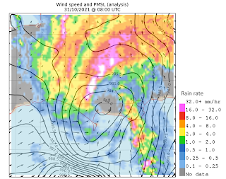
Hourly rainfall accumulations are used by Meteorologists, and Hydrometeorologists, such as those in the Flood Forecasting Centre (another Environment Agency and Met Office partnership). Rainfall observations on the ground are used in combination with rainfall radar data. Monitoring rainfall is essential to inform future weather and flood forecasts and warnings.

https://www.metoffice.gov.uk/weather/guides/observations/how-we-measure-rainfall

Since this data set has become available, the number of observations received by WOW has increased significantly from 1.2 million observations per day in September 2022, to 1.35 million observations per day in October 2022. The EA automatic rainfall data accounts for roughly 150,000 of those daily observations. 


Thursday, February 24, 2022

Using WOW observations to capture high impact weather events

 Weather observations recorded by the WOW community are extremely valuable to research and development work at the Met Office, particularly for what we call “nowcasting” (0-2 hour forecasting). One application that directly uses your [BC1] WOW observations is our Mesoanalysis system. This system produces a rapidly updating UK-wide picture of current weather variables (such as pressure and temperature). This is useful to forecasters for situational awareness and as a tool to understand how the environment is evolving and where high-impact weather such as thunderstorms and strong winds may be likely to develop.

WOW observations are quality-controlled and bias corrected before being interpolated to produce a best estimate of current weather over the UK. The high volume and density of the network of WOW sites allows us to capture regional weather features more accurately than using conventional weather observations alone. Over the last year the mesoanalysis system has been developed to combine WOW observations with Numerical Weather Prediction (NWP) model data. Using model data allows us to extend the domain over the sea and help fill the gaps and give more confidence over regions with sparser observations.

Here we give a recent example where WOW data were found to add value during a high impact event over England last Halloween.

On the morning of 31st October 2021, a small low pressure system developed along a cold front off the south coast of England, with high wind speeds to the south of the low pressure centre. This so-called ‘mesolow’ made landfall over Dorset around 8am and tracked north-eastwards across England, passing over the North Sea off the Yorkshire coast around 12 noon. It brought with it significant wind damage to trees and property and disruption to the public transport network (Holley et al., 2022).

Although this mesolow was apparent in NWP model output, there was some uncertainty in the intensity and exact positioning of the feature. By making use of WOW observations, the mesoanalysis system was able to produce an accurate representation of both the location of the low pressure centre and the high wind speeds associated with it, as seen in the figure below.

Figure of the wind (arrows) and pressure (contours) fields from the mesoanalysis over Dorset on the morning of 31st October. This is overlaid by radar data to help show the accurate positioning of this feature.


By using WOW observations forecasters are able to improve their situational awareness of features like the one seen in this example. This information can be used to improve warnings and provide advance notice to areas likely to be impacted. The more observations we have, the better this mesoanalysis system can be, so thank you for continuing to submit your data on WOW!

Holley, D. and members of TORRO (2022), Halloween windstorm and tornadoes in England, 31 October 2021. Weather.