Tuesday, December 17, 2019

Reflecting on a record-breaking 2019

Back in July, the UK surpassed its maximum temperature record during an exceptional period of heat. Persistent low pressure sat across eastern Europe and Russia, alongside another area of low pressure that had stagnated just to the west of Europe (occasionally bringing unsettled and cloudy weather to parts of Spain and the UK), trapping an area of high pressure in between. 
MSLP analysis chart - valid 06 UTC 25th July 2019.

This allowed anticyclonic conditions to set in across much of central and western Europe, bringing clear skies, plenty of sunshine by day and light winds too. This weather combination ensured that by the 22nd July (Wednesday) temperatures were beginning to rise into the high 30's, with the peak heat concentrated across parts of France, Belgium and the border region between Germany and the Netherlands. Indeed, by the end of Wednesday (24th), the Belgium national met service (RMI - Royal Meteorological Institute) confirmed that the temperature in Kleine-Brogel had peaked at 39.9°C during the day. Meanwhile KNMI released a statement, stating that the official maximum temperature record for the Netherlands had been surpassed in several locations on the 24th, with the highest temperature (39.3°C) recorded in Eindhoven.

As for the UK, a breezy and rather cloudy start to Monday 22nd July gave way to increasing sunshine and lighter winds by Tuesday as an approaching cold front swung up towards the northwest of the UK. This allowed a southeasterly feed of air to develop through the day across much of the country.  Even at this point, numerous AWS (Automatic Weather Stations) on WOW recorded in excess of 35°C, although an official UK maximum temperature of 33.7°C was recorded at Northolt.

Intense overnight thundery downpours spread their way across England and Wales, clearing to brighter skies for a time on the 24th, although a band of cloud arrived from the west during the afternoon capping temperatures somewhat in across central and western parts. In the east, however, back garden AWS sites suggested 30°C+ temperatures across parts of East Anglia, Cambridgeshire and London. In fact, the official maximum was recorded at Writtle (34.3°C).

Visible satellite image taken on 25th July
By Thursday (25th), low pressure had retreated westwards a little and was now just to the west of Northern Ireland, allowing a more widespread stream of hot air from the continent to feed across the UK. Official Met Office observation sites across parts of Wales and Scotland recorded temperatures in excess of 30°C, whilst numerous official sites across England saw temperatures rise into the mid 30's.

With a maximum UK temperature record of 38.5°C previously recorded in Kent (2003), unsurprisingly, there was a lot of interest from a range of press outlets regarding the maximum temperature on the 25th July. 

Multiple WOW locations recorded temperatures in the high 30's, with a few recording in excess of 40°C by 3pm. Clearly many journalists were watching WOW with some interest at the time as some journalists even quoted temperature readings from individual weather stations. Likewise, Met Office Meteorologists were keeping an eye on WOW alongside official Met Office network temperature data.
UK WOW observations recorded 15:00-15:59 UTC 25th July 2019.

Whilst WOW data was not treated as official UK observational data, it did provide a steer as to where the highest temperatures could be found in real time (in three areas; Cambridgeshire, London and Kent). Temperature readings from WOW also filled in data sparse gaps in official Met Office networks (often in towns and cities), providing an indication of just how widespread the heat was.

WOW observations near Cambridge recorded 15:00-15:59 UTC 25th July 2019.
However, as the Met Office has a number of official networks, that range from official automatic observation sites (that report in as near to real time as possible) to Voluntary Climate Network sites, it wasn't possible for the Met Office to release the highest temperature from the 25th July on the same day. It was not until the next morning that the UK learnt just how high the temperature had risen on the 25th. As it turns out the highest temperature was actually recorded at Cambridge Botanic Gardens - a Voluntary Climate Network site, manually read once every 24 hours by volunteers. Consequently, this particular site did not report in on the hour or the day but delivered a dramatic pause overnight until the value was released into WOW at 0900 UTC on the 26th July.

A provisional maximum temperature of 38.7°C was released by the Met Office thereafter. Meanwhile, in the background, a rigorous series of processes were undertaken by Met Office staff in order to verify this figure. These processes included:
  •          A site inspection and sensor inspection
  •          Review of the temperature trace
  •          Discussion with the onsite climate observer to ensure the correct processes were followed on the day (i.e. the Stevenson Screen was not opened other than at the prescribed time)
The result was a verified record at Cambridge Botanic gardens of 38.7°C.

It is worth noting that there were some serious impacts of the exceptional temperatures seen in late July. For example, in the UK, the rail network was severely affected across south-east England with train cancellations and main lines closed out of London due to concerns with rail buckling. Meanwhile, damage occurred to overhead electric wires as they sagged in the heat, and trackside vegetation caught fire in several locations. In addition, the exceptionally hot weather made conditions difficult, particularly for the frail and elderly. Further afield, as temperatures rose into the 40's across parts of France, Belgium, Germany, Luxembourg and the Netherlands, a number of fatalities were reported.

Monday, August 5, 2019

Eskdalemuir Observatory – Centennial celebrations

The World Meteorological Organisation (WMO) has recently awarded Eskdalemuir Observatory Centennial Observing Station status. The WMO issues this status to nominated stations that have provided long-term, high-quality climate records that tell current and future generations about climate variability and trends.

Eskdalemuir Observatory today. 

Eskdalemuir Observatory is owned by the Natural Environment Research Council (NERC) and operated by the British Geological Survey (BGS). Eskdalemuir Observatory is part of the UK Met Office official observation network and the data that it provides is available in WOW. The observatory is also part of the Global Climate Observing System(GCOS); one of only 8 observing stations in the UK incorporated into this important climate monitoring network (Stornoway, Aldergrove, Waddington, Rothamsted, Camborne, Lerwick, Eskdalemuir and Shawbury are all classed as GCOS surface network stations).

Centennial celebrations


On Thursday 18 July, nearby residents and former staff joined BGS and the Met Office to celebrate its new status and find out more about the world-leading science that takes place in the observatory’s offices and bunkers.

Stuart Goldstraw (Head of Observations Operations, Met Office) & Pete Harvey (Senior Met Officer, Eskdalemuir).

Chris Turbitt from BGS (the Observatory Manager) said, "We were pleased that members of the local community and former staff members, both BGS and Met Office, were able to join us to celebrate. The observatory opened in 1908 and since then has been a renowned site for magnetic, seismic and of course meteorological observations."

Meanwhile, Stuart Goldstraw (Head of Observations Operations at the Met Office) said, “Eskdalemuir Observatory provides meteorological data for a global network of high quality sites, as well as forming part of the Met Office Climate and Synoptic network. We are proud this partnership of over 100 years has been acknowledged with the award of WMO centennial observing station status”.

Pete Harvey & Claire Brown (Eskdalemuir Site Manager).
Visitors to Eskdalemuir were given a tour round the observatory and enjoyed a series of talks from BGS and Met Office experts.

The History of Eskdalemuir Observatory


Eskdalemuir Observatory is world-renowned as a leading geophysical and meteorological observation station. This reputation comes from the long, unbroken, high quality recordings that have been made possible by a remote site that was well chosen and has remained almost unchanged for over a century.

The main building seen from near the Underground
Magnetograph House (note the anemometer mast on the roof).

The origins of the Observatory can be traced to London in the mid-19th century when measurements of the Earth’s magnetic field began at Kew Observatory. By the end of the 19th century, these measurements had become unsustainable in London as the electrification of the capital's tram network caused increasing disturbance to the magnetic records.

By 1903, The Royal Society had identified a new site for the Kew instruments - on Nether Cassock Farm in the Parish of Eskdalemuir; a location sufficiently far enough away from existing and future sources of electrical and magnetic interference (including the national railway network). The land was provided in trust by the Duke of Buccleuch to His Majesty’s Department of Works and Public Buildings, “for an Observatory or other scientific purposes, and for no other purpose what so ever”.

Aerial view of Eskdalemuir Observatory.
The labour required to build and run the new observatory was assigned to the recently formed National Physical Laboratory, assisted by a substantial contribution from a London tram company. Many of the early magnetometers were transferred from Kew Observatory and the magnetic measurements were supplemented in the initial years by atmospheric electrical measurements and daily measurements of air temperature and pressure.

Meteorological measurements began officially in 1910 (when the Meteorological Office took over operation of the Observatory). One of the early geophysics experiments in the post-World War One years involved laying a series of large loops of copper wire around the Observatory (and nearby Dumfedling Hill) to detect geomagnetically induced currents, although a more important role of these induction loops was to evaluate the feasibility of detecting passing submarines in the vicinity of estuaries and harbours.

Seismometers were housed in the main observatory building until 1925. However, a dedicated vault was built on site in 1964 to accommodate instruments of the World-Wide Standardized Seismograph Network (and latterly BGS and US Project IDA instruments); Eskdalemuir being one of the quietest seismic stations in the world at long periods. Recordings have since been used to locate events such as the magnitude 4.7 Longtown earthquake (Boxing Day, 1979), and by air crash investigators timing the Lockerbie disaster (1988).

View of part of the Eskdalemuir enclosure, showing the entrance to the underground room where seismological & magnetic 
instruments were kept.

Management of the Observatory passed from the Meteorological Office to the Natural Environment Research Council (NERC) in 1967, and by 1974, staff numbers peaked at just under 30 (due to the wide range of science being carried out on site). However, with the advent of automatic instruments and digital communications in the 1980s, staff numbers gradually decreased. Today, one BGS member of staff remains, alongside two Met Office staff members.

Main buildings at Eskdalemuir Observatory.
These buildings provided office space & accommodation for staff, including Lewis Fry Richardson
(Superintendent at Eskdalemuir, 1913 - 1916). Richardson went on to develop the theory of Numerical Weather Prediction.
The variety of geophysical measurements has, however, continued to expand. Eskdalemuir is well regarded as a pristine measuring environment, hosting continuous GNSS monitoring, magnetic induction coils, geo-electric probes, absolute gravimeters and VLF radio detection – studying physical phenomena from the core of the Earth to the ionosphere and beyond. Today, magnetic recordings are used in real-time to navigate drilling for oil and gas below the North Sea and assessing the effect of space weather events on the electricity distribution network. Although the applications have changed, the fact that the site and the measurements made there are as relevant today as they were over a century ago is a testament to those scientists who made the decision to establish an observatory at Eskdalemuir.

Tuesday, March 5, 2019

Buxton Weather Station - A brief History

The following blog post has been written by Michael Hilton, a voluntary observer in Buxton. The original, unabridged, article can be viewed here. The weather station at Buxton has been part of the Met Office's network of climate sites since the 1870s. The voluntary observers at Buxton use WOW to upload their daily climate observations. The observer's thoughts and views below are their own. 

The Buxton Slopes Met Office site, is a Climatological Weather Station, (a Climatological Weather station takes daily readings to create a long term climate record, whereas a Synoptic Weather station records more frequent, often real-time, readings with the primary function of forecasting). The Met Office operates the Voluntary Climate Network alongside the automatic Synoptic Network.  The Buxton site is some 100 metres to the North of Buxton Town Hall, at map reference SK 058 733 (Latitude 53 15’ Longitude 1 54’). The site is at an altitude of 307 Metres above sea level.

This site is managed by The Met Office, and manned by a group of local volunteers, who attend the station each morning, 365 days a year, at 09.00 GMT, to take readings.  Some 22 readings and observations are taken on every visit, and these are entered by the volunteer team, each morning, through an online Met Office portal (WOW), for use in real time forecasting – and for inclusion in Long Term Climate Records for the UK.

We also maintain a written book of all the daily  observations – in much the same way readings have been noted since the mid 1800’s – of course these will be preserved, and passed on to future generations.


All approved Met Office sites, comply with global standards, set by the World Meteorological Organisation. Our Volunteers have received Met Office training in order to meet those standards. This ensures the quality and reliability of readings generated by the Buxton Station.  Maintained high standards, ensure Buxton readings are included in the Met Office Climate Records for the UK.   This national database is accessed by many researchers and others, for a myriad of purposes. The Buxton site continues to provide information to local people and visitors to the town, and to commerce, industry, schools and universities.


Buxton Climatological Station is one of the longest, continuously recording weather stations in the UK. The station has unbroken records going back over 150 years, to 1865.

In the middle of the 1800’s, there were many serious outbreaks of diseases like the cholera, typhus, etc. outbreaks which resulted in many deaths, particularly of young children.   Doctors before this time did not realise that these diseases were spread by contaminated water. They thought the diseases came from airborne sources, the famous “miasmas”That would explain a growing interest in climate data. When sinks were first installed in bedrooms to replace the old jug and washbasin arrangement, people were very suspicious of this new-fangled idea. They were afraid that the “miasma” would come up through the plughole and contaminate the bedroom with deadly diseases and the solution was to keep the plug firmly in the basin to stop the “miasma” spreading into the room!


Also, in the mid-nineteenth century, doctors considered that a change of climate and exposure to pure, fresh, bracing air had a stimulating effect on an invalid’s system. As a result, mountain health resorts became very popular and, in order to justify promoting the benefits of Buxton’s climate, it was essential to have accurate data.

So a major factor in the founding of the Buxton Station was in response to the realisation that the weather did have an influence on health and diseases.  Scientists knew by this time that there was a link between outbreaks of these kinds of disease and current weather conditions, but there was no local weather station making regular readings.  Without this data, doctors couldn’t predict or prepare for the outbreaks when they occurred.

In 1865, the people of Buxton, subscribed to the setting up of a weather station, to record temperatures, rainfall, and other details. This was initially placed in the grounds of the Devonshire Royal Hospital.  Readings in the late 1860’s to 1870’s were taken by Edwin J Sykes, FRAS, FMS.   Edwin J Sykes was a Dispensing Chemist.  He was the resident dispenser to the Devonshire Hospital from about 1868 to 1873, and in 1873 bought the business of Mr Acton at No 5 The Quadrant and succeeded him as a Family and Dispensing Chemist. He continued to act an honorary meteorologist at the hospital. The Devonshire Hospital and Buxton Bath Charity Annual Report for 1874, Records the following “Mr. Sykes, who had acted as Honorary Meteorologist to the Hospital during the five years of his residence in the Hospital, kindly continues to perform these duties without payment.”

In 1874, the Meteorological Office took on Buxton Weather Station as one of their official climatological stations:
The meteorological report which is annexed to the 1874 Devonshire Hospital annual report states “The year 1874 was one of great importance in a meteorological point of view. Several new and necessary systems have been suggested, and to a considerable extent carried out, under the superintendence of many distinguished naturalists- and meteorologists, who have established a method of co-operation for the investigation of such periodical phenomena of nature as depend on the progress of the seasons. To this end, several observatories have been recognised by the Meteorological Society, for the purpose of simultaneous observations twice daily: it has pleased the Council to distinguish the observatory at Buxton with that honour. The chief physical conditions to be observed are : The highest and lowest temperatures of the air daily;  the intensity of solar radiation; the humidity of the air; rainfall and snow; frost; occurrence of storms; direction of the wind; the movements and aspects of the clouds; and the general state of the sky.” (We still take most of these same readings today,  together with many other readings such as “wet bulb” temperature to calculate dew point & humidity, grass tip temperature - and temperature readings down into the earth at 10cm depth, 30 cm depth and one metre depth).

In August 1925, the equipment, together with the gated and railed enclosure, was moved to the present site, on The Slopes. 


Mr Sykes continued taking readings into the late 1880’s, and was followed by a succession of other volunteers from the town.

Around 1990, High Peak Borough Council took over the readings. At first, the readings were recorded by John Fletcher, the Market Inspector. Around 1995, a member of the Environmental Health Team took over - he became well known as  “Borough Meteorologist” – His name was Stephen Green – he took daily readings, and maintained the records, as well as transposing many long term records into "e-form".  Stephen tells me "as well as the morning readings, we also used to be part of the "Health Resort Scheme". This meant taking a second set of readings at 17.00 pm, and phoning them through to the Met Office. This was when Buxton readings (amongst others) appeared in the National newspapers. Stephen maintained his role for more than 20 years, until he retired in 2015.

After Mr Green retired in 2015, the Environmental Health Team continued to maintain the readings, but pressure on local government resources, meant that this daily duty was causing difficulties for the Council team. Because of these manning difficulties, in May 2015, the Met Office Regional Network Manager, Gill Allbones, advertised for volunteers to take over the readings, and maintenance of records. With 150+ years of unbroken records, it would have been a great loss to stop the recordings – these long unbroken records, are a valuable resource for researchers – and the long history, is a matter of some prestige for the town of Buxton, and the Borough of High Peak!

Our Slopes Team formed in June 2015, received initial training and support from the Met Office and support from the Environmental Health Team – and we have been in place since then – and we are proud to have never missed a day!  We currently have around 12, wonderful and committed volunteers, which seems about the right number to maintain regular attendance, whilst keeping the duties not too onerous.

I co-ordinate the activities of the team, and carry out day to day repairs and maintenance of the equipment. Our Met Office Manager ensures that replacement and consumable equipment is made available when required.  In addition, the Met Office inspects and calibrates every aspect of the equipment, and the site, regularly – this to maintain accuracy – and to ensure our compliance with global standards.


If you would like to know more about the Met Office Buxton site, access records, add to this tale, or even enquire about joining the volunteer team, please contact Michael via www.buxtonweather.co.uk


Friday, February 8, 2019

WOW in schools

WOW is a platform for anybody to submit, share and display their weather observations. A couple of new sites have recently appeared on WOW, linked to Primary Schools who have opted to join the WOW community. 

The Beacon Church of England (VA) Primary School, Exmouth, Devon, are now sharing their observations on WOW:


Mum of two, Debbie, decided to purchase a weather station for this school. After doing some research she opted for a Watson W-8681 wireless weather station. With the help of one of the teachers and the school's I.T specialist they built the weather station and mounted it on the roof of the school:


Advice about how to best site a weather station can be seen here. It may be difficult to find the perfect location, particularly in an urban environment. However if you share details on your weather station's exposure when setting up your WOW site, any siting issues can be taken into account, making the data more useful to others. More details on how to rate your site in WOW can be seen here. Once up and running the majority of weather stations will require some additional software in order to link them up to WOW. There are a number of freely available third party software packages, some of which are listed on this page. The WOW team are always looking to add more options to this list, if you want to share your software please comment below or send us some feedback. The Beacon School decided to use Cumulus weather station software to link their weather station to WOW.  This is currently running on a laptop, but the school are investigating using a Raspberry Pi to reduce running costs. 


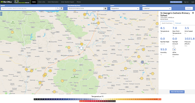
St George's Catholic Primary School, Taunton, Somerset, have also recently set up their own weather station, with a little help from Dad Adrian. They installed a Davis Pro 2 Weather Station. In order to log and visualise the data from this weather station a data logger and the Davis 'WeatherLink' software are required. Once this was all up and running Adrian used Cumulus software to start uploading the data to WOW. This weather station has been mounted on a long pole on the side of a building to improve it's exposure: